Tom Sharpe's Antarctic Diary Thursday 24 November 2011

John Rowlands, 5 Ionawr 2012

Thursday 24 November 2011

This morning we landed by helicopter on the beach at Cape Bird on the northwestern side of Ross Island and hiked north to an Adelie penguin rookery, with perhaps 70,000 pairs of birds.

Much smaller than Emperors, these are feisty little beasts, the most southerly breeding penguin in the world. It’s always entertaining to watch them carrying pebbles to add to their stone nests, squabbling with one another, and waddling back and forth across the ice to the water. On previous trips to Antarctica I’ve seen two Adelies go at one another with a scary degree of fury.

While we were watching the Adelies, it started to snow and we witnessed a real Antarctic scene as the black backs of the penguins turned grey and then white. The wind grew stronger and visibility dropped, so we had to abandon our landing and get everyone back to the ship.

Friday 25 November 2011

We’re now the furthestmost south ship on earth, and have the weather to prove it. Our plans today were a visit to see the facilities at the large US McMurdo Station and New Zealand’s Scott Base. Also here is the hut from Scott’s first expedition in 1902. But the weather wasn’t on our side. It’s been blowing a blizzard all day (well it is summer here, after all) with the windchill temperature down to -40, the temperature at which the Celsius and Fahrenheit scales meet.

The ship is covered in snow, the wind plastering it to the superstructure. But during a brief lull in the storm this evening, we did get a view of a partial solar eclipse, which was a great bonus. We’re staying here tomorrow to see if the weather improves enough to fly the helicopters.

Saturday 26 November

By this morning the blizzard had died down, but the wind was still too strong for the helicopters to fly. We waited all morning, then just as the ship was pulling away the wind dropped just enough. So it was a quick dash to get changed and grab a sandwich, then out to the helideck for a 20 minute flight south to the site of the hut from Captain Scott’s first expedition.

The hut is situated at the end of a long peninsula at the southern end of Ross Island. It was convenient not only for Scott’s Discovery expedition of 1902-04 but also for later Scott and Shackleton expeditions. The interior contains artefacts from all of these, most notably from the Ross Sea party of Shackleton’s Imperial Transantarctic Expedition of 1914-16. Seals killed by Shackleton’s men nearly 100 years ago lie on the verandah on top of sails from Scott’s ship. Seal blubber inside still drips oil onto the floor. Their last meal can still be seen in the frying pan.

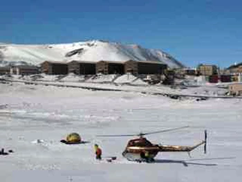
Next to the hut is the large US base of McMurdo Station. Looking like a frontier mining town, it’s not the most attractive site in Antarctica, but it is an important staging post for the scientific field parties heading out on the ice. A short distance away is the New Zealand Scott Base which fulfills a similar role and also provides facilities for the Antarctic Heritage Trust who have been conserving the historic huts.

The view today was spectacular, across the fast ice to the high ice covered mountains of the Royal Society Range.
Tom Sharpe's Antarctic Diary 2012-01-03

John Rowlands, 3 Ionawr 2012

Tuesday 22 November 2011

Overnight we sailed across McMurdo Sound and pushed into the fast ice along the coast of the mainland. It was a beautiful day today, except where we wanted to be - in the mountains.

There, low cloud meant the helicopters couldn’t fly. So instead we spent the morning walking on the ice around the ship. Our presence attracted the attention of a group of Emperor penguins who were just as interested in us as we were in them. They were definitely there to have their pictures taken! They leapt in and out of the water, waddled back and forth, stood, posed and almost smiled for our cameras.

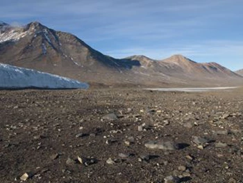
By early afternoon the weather showed signs of improvement, so we flew across the fast ice and into the Taylor Valley, one of the Dry Valleys. These are remarkable features, the largest ice-free area in the continent. Taylor Valley was discovered by Scott on his first expedition while returning from a sledging trip to explore the Polar Plateau with Edgar Evans from Rhossili on Gower.

The Dry Valleys are a polar desert where the rocks are smoothed and sculpted by sand blown by katabatic winds which hurtle down from the Antarctic ice sheet at speeds of up to 200 mph. They attract a lot of scientific attention, especially from NASA, as this is probably the closest we have to a Martian landscape and climate. It was a real thrill to experience this incredible landscape.

The valley is strewn with moraines with huge variety of rock types. Two geologists from Scott’s last expedition, Frank Debenham and Griffith Taylor, explored this valley and collected from these moraines. This gave them samples of rocks from deeper into the Transantarctic Mountains which they did not have time to explore.

Wednesday 23 November 2011

After a bright sunny night, we awoke to find ourselves back in the fast ice of Ross Island, this time offshore of Cape Evans. Visiting Shackleton’s Hut was wonderful, the Dry Valleys exceptional, but today was very much the icing on the Ross Sea cake, and for most of us, the whole reason for this trip - a visit to Captain Scott’s hut, the hut from which he left for the South Pole and to which he never returned.

Almost buried in snowdrifts, the hut has a powerful presence, seeped as it is in Antarctic history. Stepping through the door was a strange experience. In front of me was a large room that I knew well, but I was seeing it for the first time in colour. I know this hut from the famous photographs of Scott’s expedition photographer, Herbert Ponting.

I was standing where he stood, at the end of the long table, when he took the picture of Scott’s birthday. I stood between the sleeping bags of Teddy Evans and Edward Wilson, from where Ponting photographed Scott sitting at his desk. I saw the empty Tenements, the bunks of Apsley Cherry-Garrard, Birdie Bowers, and Captain Oates, and could visualise them there, as in Ponting’s photograph. Above Oates’ bunk - his pinups: pictures of horses and dogs. Atkinson’s laboratory, his test tubes and equipment still on the bench; the Geologists’ Cubicle, with rocks on the floor beneath Frank Debenham’s bunk; Ponting’s darkroom, still smelling of developer and fixer; the Stables where Oates cared for the ponies, and the stove he used to heat their chaff; Clissold the cook’s galley with its stove, utensils, and canned foodstuffs; and, dividing the hut, a wall of crates of Coleman’s mustard, Fry’s chocolate and other supplies. All of these are still where Ponting photographed them a century ago.

Of course, a feeling of sadness and tragedy pervades this hut; it is almost tangible. Almost exactly 100 years ago, Scott, Oates, Bowers, Wilson and Edgar Evans left this building and set out for the South Pole and a frozen death.

Less well known is that this hut was used by Shackleton’s Ross Sea Party who were laying the depots for his doomed crossing of the continent in 1916. Three of their number lost their lives on the ice near here. A forlorn, poignant pencilled scribble beside a bunk records “Loses to date Hayward, Mack, Smith”. In their memory, their colleagues erected a wooden cross on Wind Vane Hill near the hut.

The setting of the hut was enhanced by some suitable weather today; kind enough at times to allow our helicopters in, but showing how quickly the weather can change here. Snow showers, fine spindrift, a driving wind and windchill of -10oC reminded us what conditions here can be like, even less than a month from midsummer.

Tom Sharpe's Antarctic Diary 2011-12-22

John Rowlands, 22 Rhagfyr 2011

Monday 21 November

We've continued to push south, although by a rather round about route to avoid the thickest pack ice, and passed 77o south latitude.

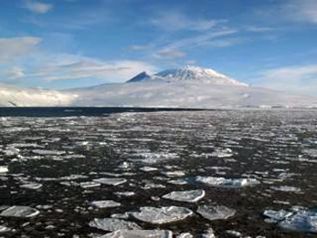
On the western horizon we had an incredible view of the Victoria Land coast of mainland Antarctica and the Transantarctic Mountains. To the south we could see Ross Island and Mount Erebus, the most southerly active volcano on earth.

We eventually broke through into a large area of open water as we entered McMurdo Sound. As we sailed along the west coast of Ross Island, we headed for a small bay at Cape Royds and ran the ship up onto the fast ice - thick sea ice attached to the land. From there it was a short helicopter ride ashore.

A walk of a few hundred metres took us to a sheltered little cove where, protected from the winds by a ridge of glacial moraine, there stood a small wooden building. This was the base hut of Ernest Shackleton's Nimrod Expedition of 1907-1909. A major conservation project by the New Zealand Antarctic Heritage Trust has recently completed work on the hut and its contents, and they've done a magnificent job. Tins of food are still stacked on the shelves, sledges rest on the rafters, clothing and sleeping bags lie on the beds, and crates of supplies are piled against the outside wall. To stand in this hut is awe inspiring.

On this expedition, Shackleton pioneered a route which Scott would later follow through the Transantarctic Mountains, and got within 97 nautical miles of the South Pole. Although he knew he could be the first to reach the South Pole, he turned back. He realised that if they continued they would not have enough food to make it back alive.

Shackleton took several scientists with him, one of whom was a St Fagan's born geologist, T.W. Edgeworth David, then Professor of Geology in Sydney. Based at this hut, David led the first ascent of Mount Erebus, 3795 metres high, and also led another team on a long sledging journey up onto the Polar Plateau to reach the South Magnetic Pole.

We had time to see the hut and take a walk to the most southerly penguin colony in the world, on the coast around Shackleton's hut. The Adelie penguins here provided an extra source of food for the expedition.

Instead of flying back to the ship, I opted to hike back across the fast ice to retrieve some marker flags we had laid out as a walking route in case the weather turned. This is perfectly safe as long as you keep a look out for tide cracks - fissures in the ice caused by tidal movement.

Their dangers were demonstrated when my hiking companion immediately fell into one. Luckily he went down only a couple of feet. It was just as well, as he had the rescue line.

Mapio Hendre'r Ywydd

Sara Huws, 22 Rhagfyr 2011

Gair bach clou i sôn am y map dwi wedi ei greu, i geisio mapio tirlun Llangynhafal a thu hwnt, yn y 1500au.

Fe welwch arno adeiladau sy'n debygol o fod wedi bod yn sefyll yn y cyfnod hwnnw. Anghyflawn yw'r map ond mi fydd yn esblygu, gobeithio. I'w greu, dwi wedi cyfuno data cyhoeddus Coflein, Ordnance Survey, Archif Sain Ffagan, google a Phrosiect Dendrocronoleg Gogledd Cymru*.

Dwi'n gobeithio ychwanegu mwy o wybodaeth am ddyddiadau'r adeiladau, lluniau ohonynt ac ati, fel mae'r gwaith yn mynd yn ei flaen. Gallwch ddefnyddio'r zoom i deithio ymhellach o filltir sgwar y tŷ:


View Llangynhafal 1510 in a larger map

* Dendrocronoleg=term ffansi am ddyddio boncyff.

Chwilio am Gartref Hendre'r Ywydd

Sara Huws, 20 Rhagfyr 2011

Dwi’n teimlo’n gartrefol, braidd, yn Hendre’r Ywydd Uchaf erbyn hyn. Mae na hogle tân coed yn y swyddfeydd a mae’n gwneud i mi deimlo’n anidding, yn edrych ymlaen at y Gwanwyn, pan gâi dreulio mwy o amser yno. Efallai eich bod wedi ymweld â Sain Ffagan droeon, ond heb dreulio llawer o amser yn yr adeilad dan sylw. Mae’n aelwyd weddol wag, yn bennaf am fod dodrefn o’r cyfnod addas yn rhy fregus i’w harddangos yn yr awyr agored. Fe ddowch o hyd i’r rheiny yn yr oriel. Yn ogystal â hyn, does dim simne ar y tŷ, sy’n ei wneud yn le anodd i weithio ynddo, ac i ymweld ag e, hyd yn oed, os nad yw’r tân yn bihafio.

Adeilad ffram-bren yw Hendre’r Ywydd, a symudwyd i'r amgueddfa yn y 1960au. Er i rywun fyw ynddo tan 1954, dwi’n gobeithio dysgu mwy am yr adeilad, a sut y defnyddiwyd ef, yn oes y Tuduriaid, gan ddefnyddio amrywiaeth o ffynonellau a sgiliau. Fe fues i’n cael modd i fyw yn coginio a dehongli yno dros yr haf and dwi’n edrych ymlaen at gael torchi llewys a phrofi sut le yw e i weithio ynddo o ddydd-i-ddydd.

Mi fydde ymroi i’r hen ffordd Duduraidd o fyw, ar yr adeg hon o’r flwyddyn o leia, yn beth annoeth i’w wneud, felly dwi am dreulio’r misoedd llwm yn archwilio cyd-destun a hanes yr adeilad.

A mae llwyth ohono. Mae ysgolheigion a haneswyr lleol wedi sgrifennu torreithiau o erthyglau am deuluoedd, adeiladau, diwydiannau a digwyddiadau Sir Ddinbych yn y cyfnod Modern Cynnar. Mae pentwr o erthyglau yn gwegian ar fy nesg, yn aros imi eu marcio â stribedi pinc a melyn. Ond rhaid dechre yn rywle. Fe benderfynais i ddod o hyd i safle gwreiddiol yr adeilad yn gyntaf oll.

Adeiladwyd Hendre’r Ywydd ym mhlwyf Llangynhafal, ger Rhuthun. Dwi’n weddol gyfarwydd â’r ardal, ond dwi erioed di gallu dweud yn sicr o ble daeth y tŷ. Dwi’n cofio gwrychoedd uchel a ffyrdd cul Dyffryn Clwyd, yn hytrach na’r hyn oedd ar yr ochr arall iddyn nhw. Yn lwcus, pan fydd yr amgueddfa’n symud adeilad, fe fyddwn ni’n creu archif am ei leoliad gwreiddiol, llawn mesuriadau, ffynonellau a mapiau. Fel arfer, maent yn gasgliadau arbennig:

Yn anffodus, yn achos Hendre’r Ywydd, gallwn weld bod mwy o ddiddordeb gan y curadur ar y pryd yn hanes a ffurf yr adeilad, yn hytrach na’r ardal a’r bobl fuodd yn byw ynddo. Roedd y ffeil yn llawn ffotograffau manwl o fframiau pren, cytiau lloi a drysau. Dim ond dau gliw oedd yno allai fy helpu’r tro hwn: copi o gopi o gopi o fap o 1830, a dargopi o fap heb allwedd arno. Nodwedd gyffredin rhwng y ddau fap oedd y stribed o dir oedd yn culhau tua un pen. Dyma ble, ym 1508, yr adeiladwyd Hendre’r Ywydd.

Yn reddfol, mi deipiais y manylion i mewn i google maps, i chwilio am stribed debyg yn ardal Llangynhafal. Roedd hynny’n gam gwag, fel y gwelwch chi:

Fe benderfynais i ailymweld â google ar ôl i mi wneud chydig mwy o waith ymchwil. Roedd yn demtasiwn i ddibynnu ar wybodaeth y wefan honno – ond mae’n tirwedd ni wedi newid cyn gymaint ers y 1500au, ac yn ogystal enwau ein tai, ffyrdd a thafarndai, ei bod yn ffynhonnell annibynadwy yn yr achos yma. Mi es yn ôl at y dargopi, a chanobwyntio ar y siapiau – lleoliadau nentydd a thraciau, a nodweddion anarferol yn y tirwedd.

Yng nghanol haniaeth hyn i gyd, daeth Coflein i’r adwy. Rwyf wedi bod yn defnyddio’r gronfa ddata i edrych ar hanes tai eraill o ardal Llangynhafal, yn y gobaith y gallaf greu pictiwr ehangach o gyd-destun bywyd y 1500au yn Nyffryn Clwyd. Mae’r gronfa ddata, sy’n cael ei rheoli gan y Comisiwn Brenhinol Henebion Cymru, yn cyflenwi cyfeirnod GPS ac Ordnance Survey ar gyfer pob heneb a hen adeilad sydd wedi’i gofrestru ganddynt. Gallwch weld cofnod coflein am Hendre’r Ywydd yma.

Mae casgliad o fapiau Ordnance Survey mawr yma yn llyfrgell Sain Ffagan, felly es ati i groesgyfeirio’r wybodaeth oedd yn fy meddiant. Mae manylder mapiau OS yn wefreiddiol, ac ar ôl chwilio'n fanwl (a chael help gan Guradur Adeiladau Hanesyddol Sain Ffagan) fe ddaethom ni o hyd i rywbeth oedd yn canu cloch. Croesffordd gam; nant gyfarwydd...

Wrth i ni edrych eto, sylwais bod rhywun wedi bod yno o'n blaen, ac yn groes i eticet archifol, wedi marcio'r map ag inc coch yn agos at leoliad y tŷ (mater o bwys dirfawr i nerd fatha fi). Ar ôl deffro o fy llewyg, dychwelais at awyrluniau google a chyn pen dim, roeddwn i wedi gosod pin yn y map. Gallwn weld yn glir bod y stribed o dir yn dal i fodoli, mwy neu lai, fel y gwelwn hi ar fap 1830. Mae'r heol gyfagos yn cordeddu fel honno ar y dargopi:

Roedd yn naturiol fy mod yn ysu i ymweld â'r lle. A diolch i google, dwi nawr yn gwybod bod safle'r tŷ yn gae o gorn melys. Er fod hynna'n swnio bach yn rhy debyg i un o ganeuon Arfon Wyn, dwi'n hapus iawn i ddechrau fy nhaith i oes Harri Tudur yn fan hyn:

Rho glic isod i ymweld dy hun:


View Llangynhafal 1510 in a larger map